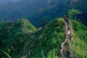
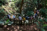
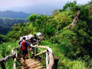
Dakeng Scenic Area lies in Taichung’s Beitun District. The city began developing it in 1976. Its elevation ranges from roughly 112 to 859 metres. Early residents settled in a broad valley, which gave Dakeng its name. The landscape includes woodland, streams and hot springs. The forests contain more than thirty kinds of deciduous trees, whose fallen leaves often form golden carpets along the trails as the seasons change.
Fourteen hiking trails cover about 17.7 km, with different gradients and terrain. Work on Trails 1 through 8 began in the early 1980s, following the ridges and stream valleys. The highest point in the scenic area is 859-metre Mount Touke. Trail No. 9 was developed in December 2005, No. 10 was completed in March 2008, and No. 9-1 in November 2013. Pavilions and viewpoints offer places to rest. Choose a route suited to your abilities and check the scenic area manager’s access notices before heading out.
The Chelungpu Fault runs through Dakeng. The hot springs were known and had been investigated before the 1999 Chi-Chi earthquake. Surveying and drilling after the earthquake helped develop local hot-spring tourism. The earthquake damaged Jungong Elementary School and Dongshan Junior High School. Their former grounds became Dakeng Earthquake Memorial Park, which commemorates the earthquake and teaches visitors about the fault. The park sits near the approaches to Trails 9 and 9-1 and Jingbuku car park. Each numbered route has its own start. Dakeng was also an important tobacco-growing area. Growers once dried the leaves in the sun. Osaka-style barns were introduced during the Japanese colonial period to cure the leaves with heat, and local records document the old buildings.